
Dwarf planets · Space Codex
Pluto
Reclassified as a dwarf planet in 2006, Pluto turned out to be anything but a frozen relic: New Horizons found nitrogen glaciers, water-ice mountains and a layered blue haze.
Dwarf planet · heart of the Kuiper belt
At a glance
Key points
- A nitrogen-ice glacier basin about 1,000 km wide
- Mountains of water ice as hard as rock
- Has not completed one orbit since its discovery in 1930
Surface
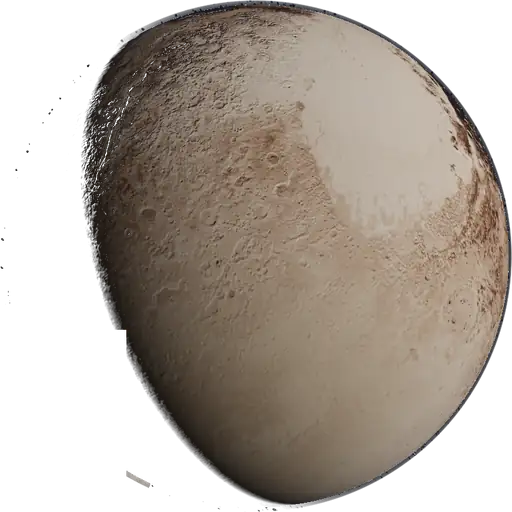
The bright 'heart' on Pluto's face is partly Sputnik Planitia, a basin roughly 1,000 km wide filled with nitrogen ice. Its surface is divided into convection cells 16–48 km across, slowly overturning like a lava lamp, which keeps it free of craters. Around it rise mountains of water ice 2–3 km high: at Pluto's temperature, water ice is as hard as rock and nitrogen ice flows over it as glaciers.
Atmosphere
A thin nitrogen atmosphere, about 1/80,000 of Earth's surface pressure, rises from the ices when Pluto is nearer the Sun. Sunlight turns methane into haze particles that stack in about twenty layers and scatter blue light, so Pluto's sky looks blue when backlit.
Exploration
New Horizons flew past on 14 July 2015 at about 12,500 km, returning the first close-up images. The spacecraft is still active more than 60 AU from the Sun, studying the outer heliosphere.
What we still don't know
Whether a liquid ocean survives beneath Sputnik Planitia, which the basin's position on the globe hints at, and how the atmosphere will change as Pluto moves toward aphelion.
About this view
The map is the USGS New Horizons global mosaic, coloured to approximate true colour. The far south was in polar night during the 2015 flyby and was never imaged, so that region is filled in. Pluto spins in step with Charon's orbit, as both are tidally locked, and its haze is drawn as a faint blue shell.
Moons
Pluto's moon has its own sourced entry.
- CharonPluto's half-sized partner
Missions
- 2006–
Pluto flyby 14 Jul 2015; Arrokoth 1 Jan 2019; now studying the outer heliosphere.
First-hand · our 3D model
How we render it
Pluto's map comes from the USGS global mosaic of New Horizons LORRI and MVIC images. The mosaic is greyscale, so we colourised it with a brightness lookup tuned to New Horizons' true-colour views. South of about 30 to 38°S the ground was in polar night during the 2015 flyby and was never imaged; that region is procedural fill, feathered into the data edge, not data. The view opens with the nitrogen-ice heart, Sputnik Planitia, turned towards you, and the globe is tilted 119.5°, which is how the model encodes Pluto's backwards spin.
Above the ground, a ray-marched single-scattering shell 220 km deep stands in for the thin nitrogen atmosphere and its tholin haze, drawn at true thickness rather than exaggerated. The haze scatters blue light strongly forward, so the limb shows as a faint blue ring when Pluto is backlit and almost disappears in front light. The Sun, 39.5 au away, is a white 5,772 K point only 49″ across, kept at least about 1.6 pixels wide so it never vanishes. Pluto's spin is matched to Charon's orbit, because the two are locked face to face. Sizes and distances are not to scale.
Related entries
- CharonPluto's half-sized partner
- New HorizonsPluto and the Kuiper belt
- Kuiper beltThe icy disc beyond Neptune
- 486958 ArrokothThe most distant world explored up close
Sources
- NASA Science: New Horizons (opens in a new tab)
- JPL Solar System Dynamics: planetary physical parameters (opens in a new tab)
- NASA NSSDC Pluto Fact Sheet (opens in a new tab)
- NASA Science: Pluto facts (opens in a new tab)
Last reviewed against these sources. Built from public NASA, ESA and JPL data; not affiliated with or endorsed by any agency.